According to
The Himalayan newspaper, more than 2.1 million people left the Kathmandu Valley for the Desain holidays in October this year, and we were amongst them. We flew to Pokhara (via Yeti Airlines) then took an 18-seater Tara Twin Otter on to Jomosom. These little unpressurised propeller planes fly at a mere 11,500 feet (3500m) so need to dodge between the biggest peaks, indeed at one point I felt I could almost lean out and grab some tree leaves from the ridges comprising the deepest valley in the world – where the Kali Gandaki winds between two 8000m peaks of the Annapurnas and Dhaulagiri himals. It was truly awe-inspiring to fly so close to my favourite mountain, Machhapuchare.
As a family when the boys were wee, we’d walked this route (as described in
A Glimpse of Eternal Snows), and then earlier this year my oldest son, Alex, and I hired a couple of 150cc motorbikes and rode along the newly almost-completed road towards Jomosom (click
transHimalayan Adventure to read more). Now we covered the distance in 20 minutes.
This time our target was Upper Mustang right up in the cold desert of the Tibetan Plateau, NORTH of the Himalayas but still within Nepal.
We only paused long enough in Jomosom (at 2720m) to buy some sun-dried apples and headed out along the Kali Gandaki as the wind was getting up, as it does by about 11 each morning. But the skies were a beautiful blue, the sun was warming, the gradient tiny and the view south to the Nilgiri himals was quite magnificent. And on our leisurely couple of hours saunter we were treated to encounters with feasting Himalayan Griffon Vultures and a hoopoe couple. Our guide from
Himalayan Sunrise, Ram Kumar Rai, told us that these are known locally as the buckwheat bird. Villagers reckon that when it comes down to lower altitudes in the spring it signals the time to plant the buckwheat crop – which was being harvested this very month.
We spent the night at YacDonalds in Kaag Beni (at 2980m) where the food was good, but we were uncomfortably reminded how the temperature plummets as soon as the sun dips below the crags. And how tough locals don’t see the need for heating but huddle in kitchens to enjoy cooking fires, the craic and perhaps a little hot rakshi.
One of the big changes we’ve seen in the 20 years or so we’ve been away from Nepal is that roads have been driven deep into the country so that it can be difficult to find untouched trekking routes. Bulldozers power through the valleys, creating scars visible for miles and often destroy traditional footpaths and mule tracks. Even so on the walk along the stony unpaved ‘road’ from Kaag Beni to Chele (at 3060m) we saw a good range of birds including wall creepers, buntings, wagtails, tree sparrows and two kinds of vultures, while I marvelled at how any of these creatures could find enough food to survive. The vegetation was sparse, scrubby and spiky. Not only do birds thrive here though, but the area has been inhabited for at least 5000 years and at Chele we saw the first of many rock shelter homes that had been carved out of the sandstone high up in the cliffs, without any obvious means of access.
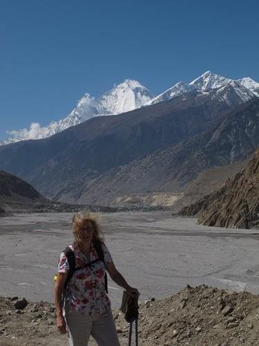 |
| Windswept author in the stony Kali Gandaki valley between Jomsom and Kaag Beni, with Dhaulagiri himal - photo by Simon Howarth |
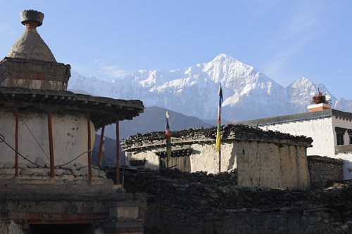 |
| Beautiful mediaevil Kaag Beni, where people store firewood on their flat rooves |
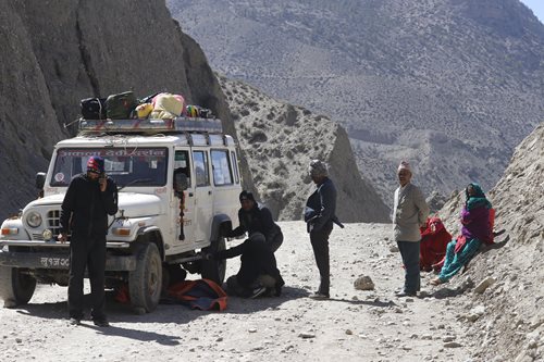 |
| Vehicle travel can have its disadvantages in Mustang - conditions are hard even for jeeps |
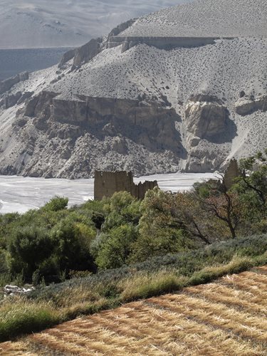 |
| An old fortified house, poplars, apricots and recently harvested buckwheat |
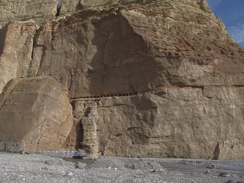 |
| 5000-year old homes - but how did people get up there? |
I've posted more on our trip to Lo-Mantang here
Bleeding mountains and
No-one is here.